
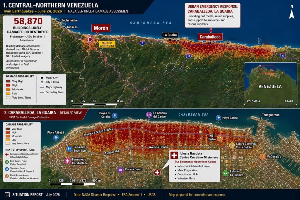
This map combines satellite analysis with reports from relief teams on the ground to illustrate the impact of the devastating earthquakes that struck northern Venezuela.
The upper map presents a regional overview based on NASA’s rapid damage assessment using radar imagery from the European Space Agency’s Sentinel-1 satellites. Radar technology can detect changes in the Earth’s surface through clouds and smoke, allowing scientists to estimate where buildings have likely suffered structural damage. Preliminary analysis indicates that approximately 58,870 buildings were likely damaged or destroyed.
The map highlights two priority response areas. Along the Caribbean coast, Caraballeda, La Guaira, experienced catastrophic destruction and has become one of Venezuela’s largest humanitarian emergencies. Next Step has established an emergency operations center at Iglesia Bautista Centro Cristiano Misionero, where volunteers prepare hot meals, distribute relief supplies, and support survivors and rescue workers.
Farther inland, Morón, near the earthquake epicenters, serves as the base for Next Step’s response to underserved rural communities facing shortages of food, clean water, electricity, and other essentials.
The lower map combines satellite damage estimates with the locations of key humanitarian operations in Caraballeda, helping guide relief efforts where needs are greatest. Although these assessments remain preliminary and require field verification, they provide an invaluable tool for emergency response.
More than a map of destruction, this is a picture of hope—communities in need, local leaders serving with courage, and a shared commitment to restore dignity and help families rebuild.
